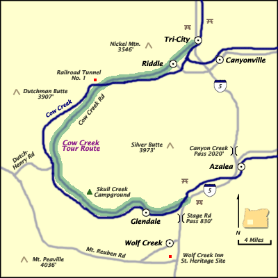
Length: 45 miles / 72.0 km
Time to Allow: 1-2 hours minimum.
Fees: No fees known.
Driving Directions
The route starts at exit 103, 21 miles south of Roseburg. The route loops toward the west and ends when it joins I-5 at exit 80, 18 miles north of Grants Pass.
Description
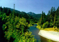
The Cow Creek Tour Route is a refreshing break from the steady highway pace; this 45-mile detour wanders with Cow Creek as it dips through the Coast mountain range. The route is spread with quaint farms and ranches, stately forests, massive rock outcroppings, and spring waterfalls.
Depending on the season, you can absorb the plethora of wildflowers or the bright reds and yellows of autumn. The route is covered in history. You can see mines and tailings from the last operating nickel mine and smelter in the continental U.S.
 Also, shortly after you pass Tunnel No.1 of the Historic Oregon and California Railroad, you can pan for gold just as miners did nearly 150 years ago. Two steel girder bridges along the route (built in 1905) are still in use today.