Cities: Burns
« Back to Cities & Regions
Burns, which was named after Scottish poet Robert Burns. Harney County is located where U.S. Highways 395 and 30 converge. Burns and neighboring Hines are a transportation hub.
|
|
View Eastern Oregon in a larger map |
Harney County boasts 10,228 square miles of land with approximately 7,600 friendly, hospitable citizens, who invite you to spend a few days, a month, or a lifetime enjoying the wonders of this vast land. Harney County is the largest county in Oregon and the ninth largest in the United States.
Established in 1889, the county seat is Burns, which was named after Scottish poet Robert Burns. Harney County is located where U.S. Highways 395 and 20 converge. Burns and neighboring Hines are a transportation hub for the region and business centers for Oregon's largest county. With its sprawling size, Harney County is Oregon's "Big Country." Vast rangelands, an immense wildlife refuge, and the 9,670 foot high, 30 mile long specter of Steens Mountain support the claim. Cattle are still big business on the century-old ranches south of Burns. Although modern machinery is part of today's scene, you can still see traditional old west cattle drives in the Blitzen Valley.
Geography:
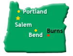
Burns is located approximately 130 miles east of Bend in eastern Oregon. It is the 9th largest county in the United States, larger than many eastern states. Known for its vast high desert and majestic Steens Mountains, Harney County is a unique and independent corner of Oregon. As its motto suggests, The weekly Burns Times-Herald "covers Harney County like the sagebrush," with a focus on the communities and the proud people who live in them.
Probably the finest and most spectacular fossils found in Harney County occur in a deposit of snow-white diatomaceous earth in the Trout Creek area southeast of Fields. A number of species of Miocene flora have been obtained by commercial collectors. The leaf imprint, nearly black, stands out in clear contrast against the snow-white matrix. Harney County is also known to be a great place for rock hounds. An official rock hounding map is available from the Highland Rock and Gift Shop in Burns. At Glass Butte, located about 50 miles west of Burns, off the highway at milepost 77, you can find obsidian, sheens (silver, gold and rainbow), red, mahogany, flame, fire, lace and more. Buchanan thunder eggs can be found at Oard's Service Station, which is 23 miles east of Burns on Highway 20. The petrified forest areas in the Stinking Water Creek Basin offer the best opportunities for the collector of petrified trees and have been posted by the Federal government to preserve this unusual forest. The remainder of the basin area contains float material of petrified wood pieces. Leaf and fish fossils are also found in the basin located south, off Highway 20, past milepost 167 east of Buchanan.