These routes in and around Portland vary in difficulty and offer something for everyone in the family
Portland has been voted one of the most bicycle-friendly cities in United States by Bicycling Magazine since 1995. There are many great rides in and around Portland. Here are five in different sections of the city with varying degrees of difficulty.
These directions are meant to get you started, but we suggest you obtain more detailed maps. Mileage is approximate.
Sauvie Island (easy)
12 miles
A ride around Sauvie Island is a passage of Spring. This flat 12-mile ride through farmer's fields and wildlife preserves is a great place to warm up your riding muscles after a wet winter or to bring friends with mixed riding abilities. This ride is a loop, but there are several places you can add on with out-and-back side trips.
To begin the ride, drive out Highway 30 North to the Sauvie Island Bridge. Turn right to cross the bridge and loop around to the left and park in the gravel parking lot.
Ride left out of the parking lot and under the bridge on Gillihan Road. You'll curve around and past pumpkin and corn fields. At approximately 6 miles, you'll come to a stop sign at Reeder Road, go left. (You can turn right here and head out toward the Sauvie Island beaches and add 9 miles each way out and back.)
You'll pass Oak Island Road on the right in 3 miles. (Take this out for a nice 6-mile out-and-back addition to the ride through groves of old oak trees and past potato fields.)
Stay on Reeder Road until you come to a stop sign on Sauvie Island Road.(approximately 10 miles) Turn left and ride along the Multnomah Channel for 2 more miles until you reach the parking area.
Blue Lake (moderate)
20 miles
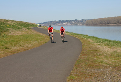
The route to Blue Lake State Park on the east side of the city is primarily a flat, off-road bike path.There's nothing like a ride along a breezy river on a hot summer day. And what better reward than a cool dip in a lake at your halfway point?
Most of this ride to Blue Lake State Park is on a flat off-road bike path. It's a straight shot out and back, so there's little danger of getting lost. The beginning few miles can get congested with runners, dog walkers and roller bladers, but it quickly clears out.
If you don't want the hassle, you can ride on the wide shoulder of Marine Drive the whole way but then you must contend with cars and semis zipping by at 55 mph.
To begin the Blue Lake ride, drive or bike north on NE 33rd Avenue until it ends at Marine Drive. Just before Marine Drive, a gravel driveway appears on the left. You can park here along the side of the road.
To begin the ride, go under the overpass onto the bike trail. Look for heron and hawks and listen for red wing black birds in the fields to the right.
At approximately 1 mile the path crosses Marine Drive. This is likely to be the most congested part of the path. At approximately 2 miles, you'll pass Sea Scout Base. Stay left to stay on the bike trail.
You'll see the airport on your right. You can stop and watch planes take off and land.
The bike path will take you under Highway 205 at about 5 miles. Just past the bridge, you'll cross Marine Drive at a crosswalk to ride on the right shoulder of the road for .7 miles. At 122nd Avenue, you'll pick up the bike path again on the right.
This part of the path takes you down along the backside of buildings. At 138th Avenue, you'll again cross Marine Drive to land back on the bike path. This is one of the prettiest sections of the route because you are riding closer to the river and don't have a view of the traffic on Marine Drive. At approximately 8 miles, you'll be spit back onto the shoulder of Marine Drive.
Ride past Interlachen Lane, and just after you enter Fairview, you'll turn right onto Blue Lake Road. At just about the 10-mile mark, you'll turn right into Blue Lake Regional Park. Admission is free to bicycle riders. Ride into the park for a quick dip in the lake.
To return to the start of the ride, follow your route in reverse.
Springwater Corridor/Eastbank Esplanade (easy)
Length varies up to 33 miles
The Springwater Corridor and the Eastbank Esplanade combine for 18 miles of mostly off-road paved multi-use trail. These trails can get crowded on sunny weekends with baby strollers and dog walkers, but the Springwater Corridor especially is a good place to bring the young riders and teach them bike safety skills.
The Eastbank Esplanade leads you to the Willamette River where you can ride along the waterfront.The Springwater Corridor takes you past Oaks Bottom Wildlife Refuge, along Johnson Creek where you'll see ducks and other water birds, and through urban farms and community green spaces. In a few spots you'll have to cross city streets, but all have crosswalks.
You can enter the Eastbank Esplanade from several places. If you're on public transportation, take your bikes on the Max or bus to the Rose Quarter. Walk Southwest from the Max platform, until you see the entrance to the Esplanade on your right (just past Wheeler Street). Ride south along the waterfront.
If you're driving, park under the Hawthorne Bridge via SE Main or Madison Street to the large fee parking area. Ride south on the Esplanade (1.5 miles from the Rose Quarter) past OMSI, where it turns into the Springwater Corridor.
The Springwater Corridor runs for 16 miles all the way out to the rural community of Boring. Other popular places to enter the Springwater Corridor are: - Berkeley Place near SE 32nd & Tacoma - Johnson Creek Blvd near SE 45th & Harney - 92nd Avenue north of Flavel St. - 122nd Avenue north of Foster Road - 136th Avenue north of Foster Road
Ride out and back as far as you feel comfortable.
Mount Tabor & Rocky Butte (moderate)
18 miles
This ride takes you through some of Portland's Eastside neighborhoods and into two city parks built on extinct volcanoes. The hills offer a great aerobic workout. Much of this ride, while on city streets, are on designated bike routes. That means the streets are either low traffic or have designated bike lanes.
For most of the way up to Mount Tabor and to Rocky Butte, you'll be following the bike route and the turns will be marked with green "bike route" signs.
Start the Mount Tabor & Rocky Butte Ride on SE 20th and Belmont at Colonel Summers Park. Ride south on 20th to SE Salmon, and turn left on SE Salmon. At SE 35th (1 mile) turn left and make a quick right onto SE Taylor Street. Cross SE 39th and turn right on 41st and left again on Salmon, left on 46th and right to stay on Salmon.
Salmon ends at 49th. Turn left and make a quick right on Belmont. You will no longer be following bike route signs.
Belmont heads uphill for 1 mile. At the 3-mile mark, turn right onto SE 69th and into Mt. Tabor Park. Mt. Tabor is closed to cars on Wednesdays, so you're likely to see lots of other bikers on those days.
Stay to the right at the park entrance and ride past a parking lot and restrooms. Veer to the left (uphill) and past the car barricade. This will take you up to the top of the park for panoramic views of Portland. Circle around and ride back down the hill staying to the left at all intersections. This will put you out of the park at SE Harrison Street.
Turn left from Harrison onto SE 76th. Ride over the speed bumps, cross SE Washington and turn left onto SE Stark and make a quick right onto SE 74th. Stay on SE 74th, again following bike route signs. Cross Burnside and Glisan. At approximately 5 miles you'll jog left at Halsey (follow bike signs). Turn left at Tillamook Street and make a quick right onto SE 72nd Drive, up the hill and past the Rose City Golf Course.
At the top of the short hill, turn right onto Sacramento and left onto NE 72nd.
You'll come to an intersection where 72nd, Fremont and Sandy all come together. Take a hard right onto NE Fremont. At approximately 9.5 miles, Fremont curves to the left and becomes NE 91st Avenue and then Rocky Butte Road. Ride this steep uphill to the top of Rocky Butte. You can walk your bike up to the top lookout point here. Circle around the loop to the left and exit at the first right.
Steep Rocky Butte Drive will bring you down to 92nd Avenue. Go left on 92nd for a few blocks and then turn right onto Tillamook at the bike route sign.
Follow the bike route signs and turn left on NE 62nd at approximately 12 miles. Make a right onto Hancock and follow that until NE 44th where you'll turn right and then take a left onto Tillamook.
Tillamook becomes U.S. Grant Place as you pass Grant High School on your right. Cross NE 33rd at 15.5 miles. Turn left onto 32nd and then pick up the bike route again by turning right onto Tillamook.
Turn left onto NE 21st and follow this as it curves around and becomes 20th. Ride 20th back to Colonel Summers Park to the end of this ride.
West Side Hills (difficult)
16 or 40 miles
This ride is not for the novice or out-of-shape cyclist. It's difficult with steep, long hills. The rewards are sweeping views of western valleys, Mt. Hood, Mt. St. Helens and Mt. Adams.
Start this ride in NW Portland on the corner of NW Raleigh Street & 25th Avenue in Portland at the Chapman School/Wallace Park. Ride South on NW 25th to NW Lovejoy. Turn right onto Lovejoy and immediately begin your uphill ride. Stay to the right as the road curves and becomes Cornell Road. Two bike paths will take you around the narrow tunnels on Cornell Road.
Turn right onto Thompson Road at approximately 2.6 miles. You'll continue uphill to a stop sign at Skyline Boulevard. Turn right. You'll stay on Skyline for 16 miles. Ride past the new homes in Forest Heights and pull into Skyline Memorial Gardens Cemetery for a rest and drink of water.
Continue past Skyline Tavern to a stop sign at Germantown Road (8 miles). If you've had enough, turn right here for the 16-mile ride. Descend Germantown for 2 miles. At the bottom of the hill turn right onto Bridge Road. Pass the St. Johns Bridge and turn right onto Highway 30. Turn right at Kittridge (13 miles). *Follow directions from Kittridge below.
If you've still got stamina, continue on Skyline and cross busy Cornelius Pass Road (12.5 miles) and turn right to stay on Skyline.
Prepare for some more big uphills and views on the right of Mount Hood, Mount Adams and Mount St. Helens. At 20.6 miles, turn right onto Rocky Point Road. This is a very steep downhill with blind curves and no shoulder. Use caution.
At the bottom of the hill, you'll turn right onto Highway 30 (23.7 miles). Stay on Highway 30 for 13 miles until you come to a traffic signal at Kittridge. *At the light for Kittridge, turn right to stay on St. Helens Road.
Turn right at 29th Avenue. The road curves and become Upshur Street. Turn right onto 28th Avenue. Turn left on Raleigh. Return to Wallace Park/Chapman School at 25th & NW Raleigh.
By KATHY BELGE
For Oregon.com